Costa Rica Map
Click to Enlarge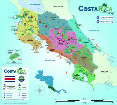


Map of Costa Rica for Planning Your Trip
Costa Rica is in Central America, between Nicaragua to the north and Panama to the southeast, with the Caribbean on one coast and the Pacific on the other. For a trip, the maps that matter show eight regions, two main airports and how long the drives really take, and they are all on this page.
Last reviewed by our team in Costa Rica: . By The My Costa Rica team in San José.
Quick answer
Costa Rica is in Central America, on the strip of land between North and South America. Nicaragua is to the north, Panama to the southeast, the Caribbean Sea to the northeast and the Pacific Ocean to the southwest. We plan trips by eight regions, and the airport you fly into decides which of them are easy to reach.
| Key fact | What to know |
|---|---|
| Where | Central America, between Nicaragua and Panama |
| Coasts | Caribbean, about 300 km (185 miles); Pacific, about 1,015 km (630 miles) |
| Size | 19,730 square miles, about 51,100 km² |
| Capital | San José, in the Central Valley, not on the coast |
| Provinces | Seven: San José, Alajuela, Cartago, Heredia, Guanacaste, Puntarenas and Limón |
| Landscape | Two mountain chains down the middle, lowlands on both coasts |
| Airports most of our clients use | Juan Santamaría (SJO), outside San José, and Daniel Oduber Quirós (LIR), in Liberia |
| Regions we plan by | Eight, from the Northern Zone to the Osa Peninsula |
Where is Costa Rica located on the map?
In Central America. Costa Rica sits on the isthmus that joins North and South America, so it is neither an island nor part of South America, two things people often ask.
Nicaragua is its northern neighbour and Panama its southeastern one. The Caribbean coast runs about 300 km along the northeast, and the Pacific coast about 1,015 km along the southwest, with the Nicoya and Osa peninsulas reaching out into the ocean.
San José, the capital, is up in the Central Valley in the middle of the country. It is not on the beach, whatever the movies show.
What is Costa Rica’s geography like?
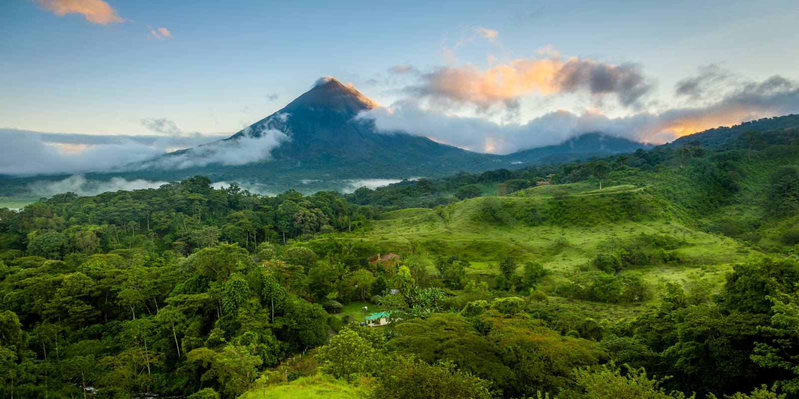
Mountainous in the middle, with lowlands and a coast on each side. Those are the main landforms and geographical features, and two mountain chains run almost the whole length of the country, and nearly everything you will see on a trip sits on, between or below them.
In the north and centre are the volcanic ranges. From northwest to southeast they are the Cordillera de Guanacaste, the Cordillera de Tilarán and the Cordillera Central, and they hold the volcanoes still active today. In the south is the Cordillera de Talamanca, a granite range quite different geologically from the volcanic north and a UNESCO World Heritage site since 1983. Its highest summit, Cerro Chirripó, is the highest point in Costa Rica.
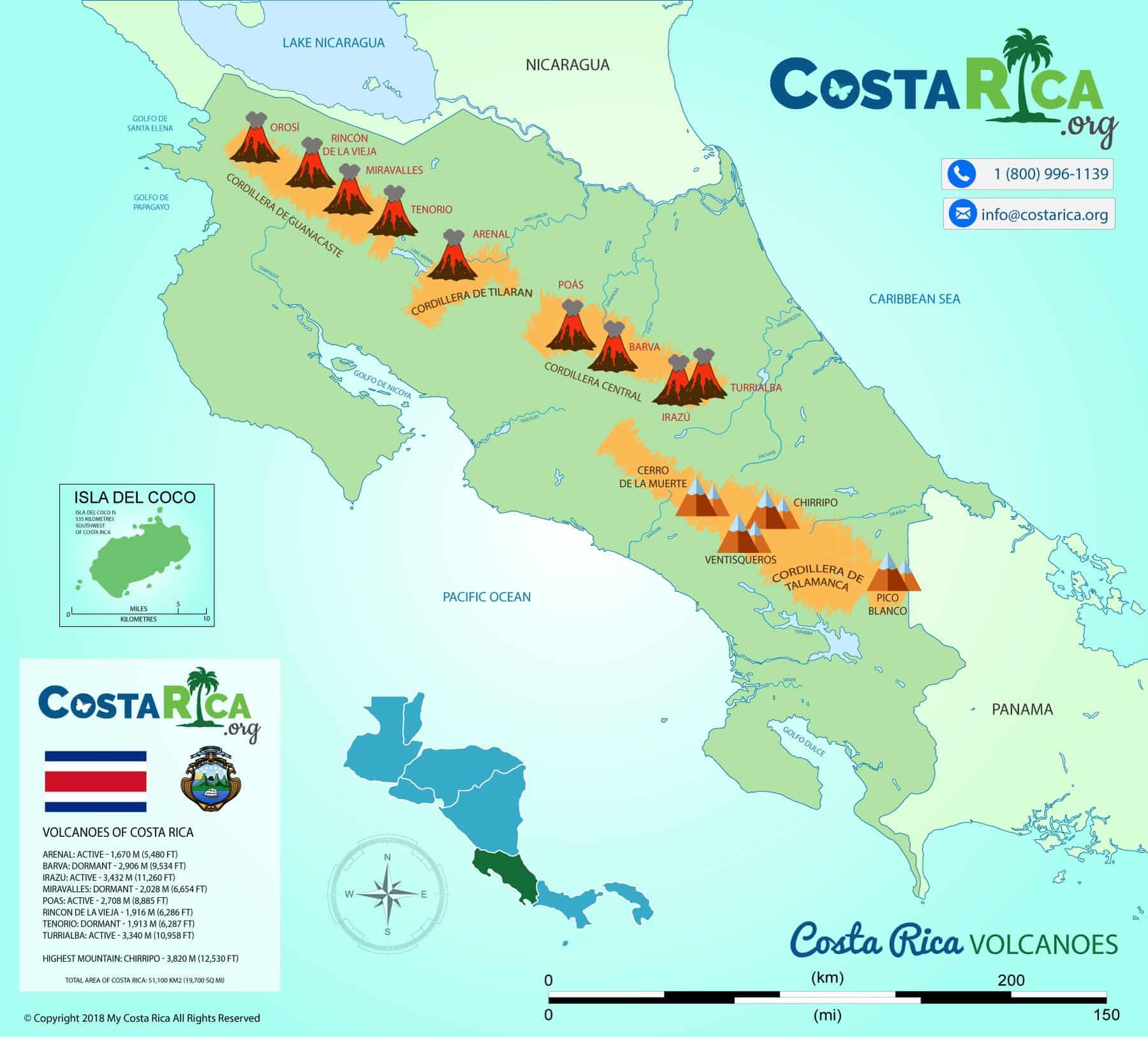
| Landform or physical feature | Where it is | On your trip |
|---|---|---|
| Volcanic ranges: Guanacaste, Tilarán, Central | North and centre | The five historically active volcanoes: Rincón de la Vieja, Arenal, Poás, Irazú, Turrialba |
| Cordillera de Talamanca | South | Chirripó National Park, the country’s highest summit |
| Central Valley | Centre | San José, and the airport most visitors land at |
| Caribbean lowlands | North and east, about a fifth of the country, under 120 m | Tortuguero and the Caribbean coast |
| Pacific lowlands | West, about a tenth of the country | Small valleys and plains behind the Pacific beaches |
| Peninsulas and gulfs | Pacific coast | The Nicoya and Osa peninsulas, with mangroves in the Gulf of Nicoya and the Golfo Dulce |
Two rivers carry the middle of the country to its two coasts: the Reventazón to the Caribbean and the Grande de Tárcoles to the Pacific.
Geography and climate go together here. The terrain is why a short distance on the map can be a long drive, and the topography is why the weather changes so much in a day. The tourism board puts average temperatures at 22 to 30°C on the coasts, while cloud forest nights drop to 5 to 14°C.
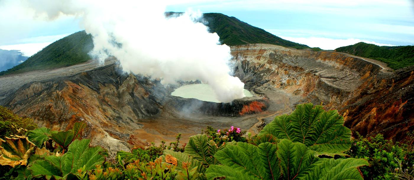
Volcanoes are part of almost every trip. The National Seismological Network at the University of Costa Rica counts at least 290 volcanic centres, and only five are historically active. See our volcanoes guide and national parks.
What are the regions of Costa Rica?
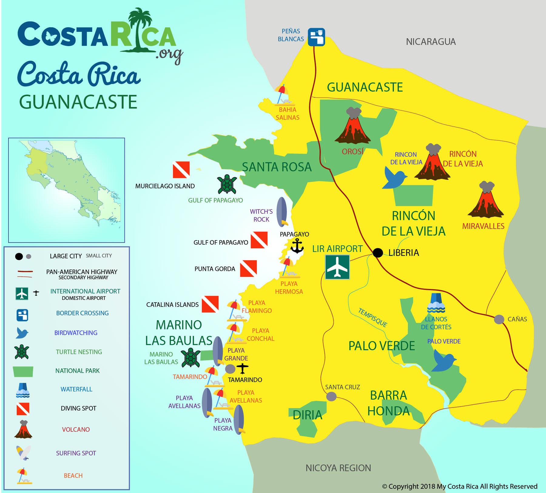
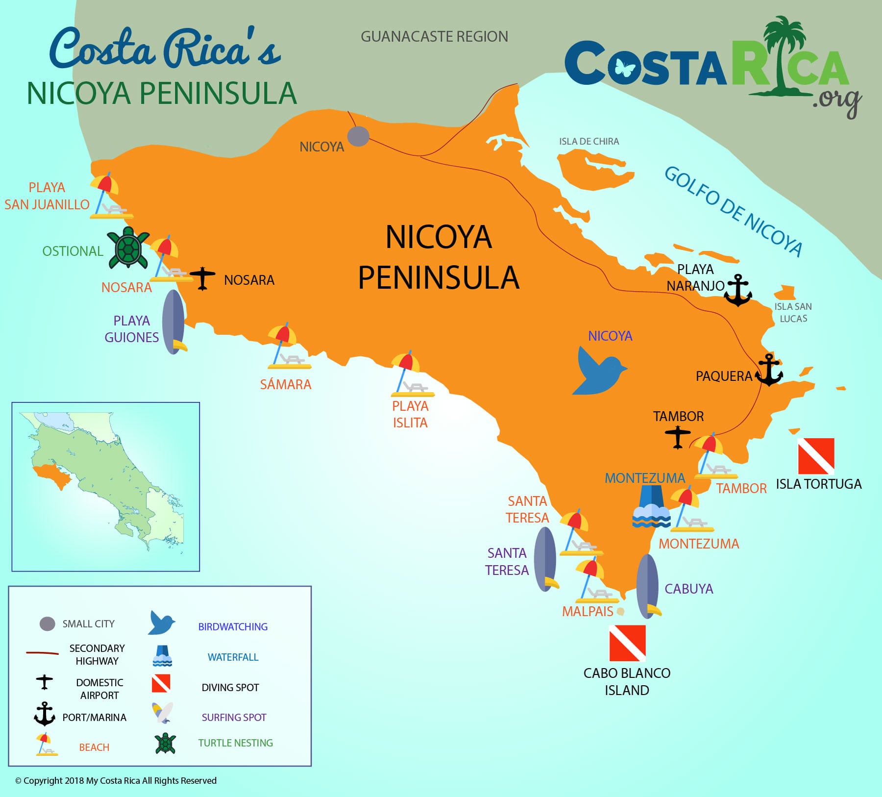
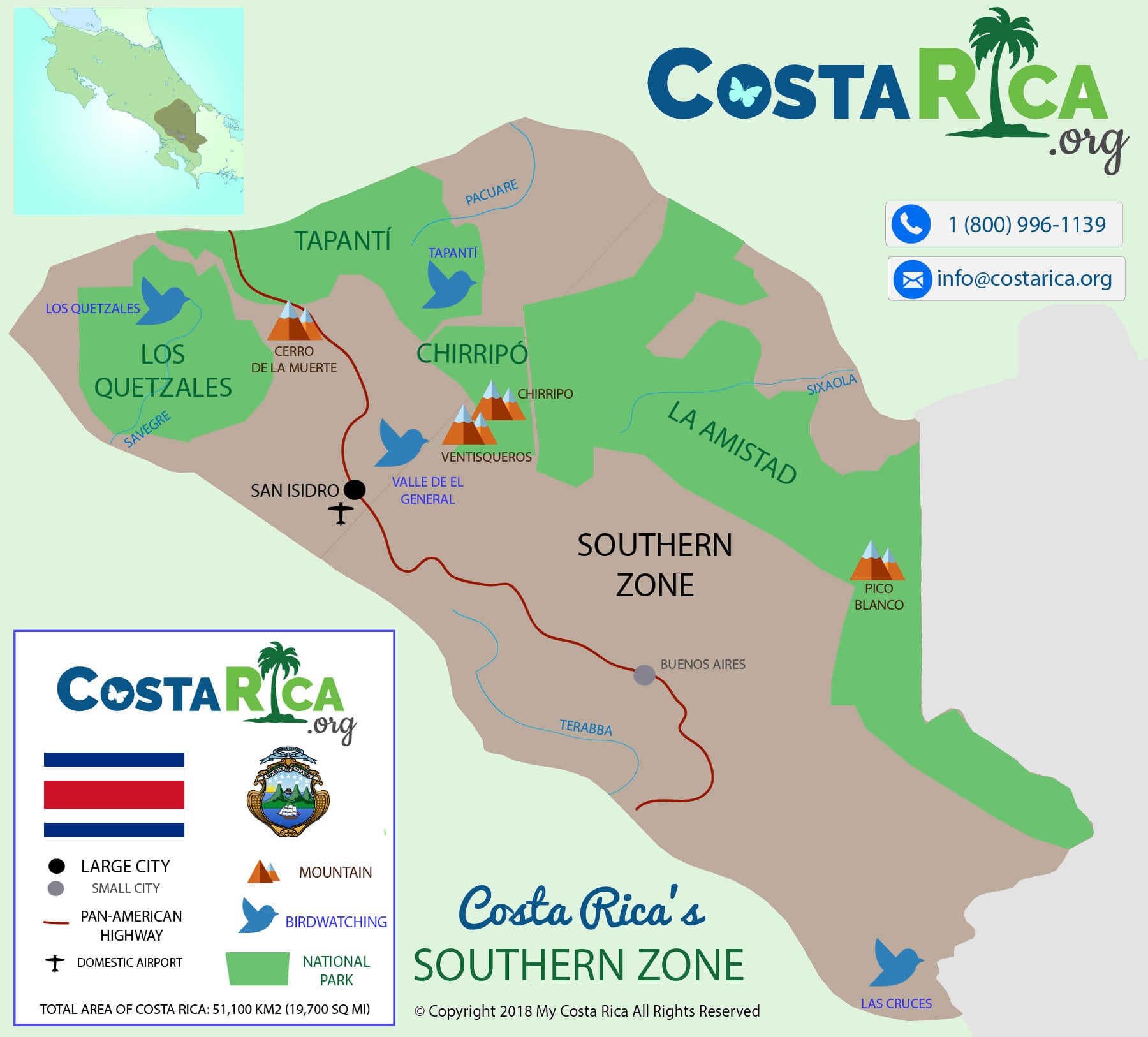
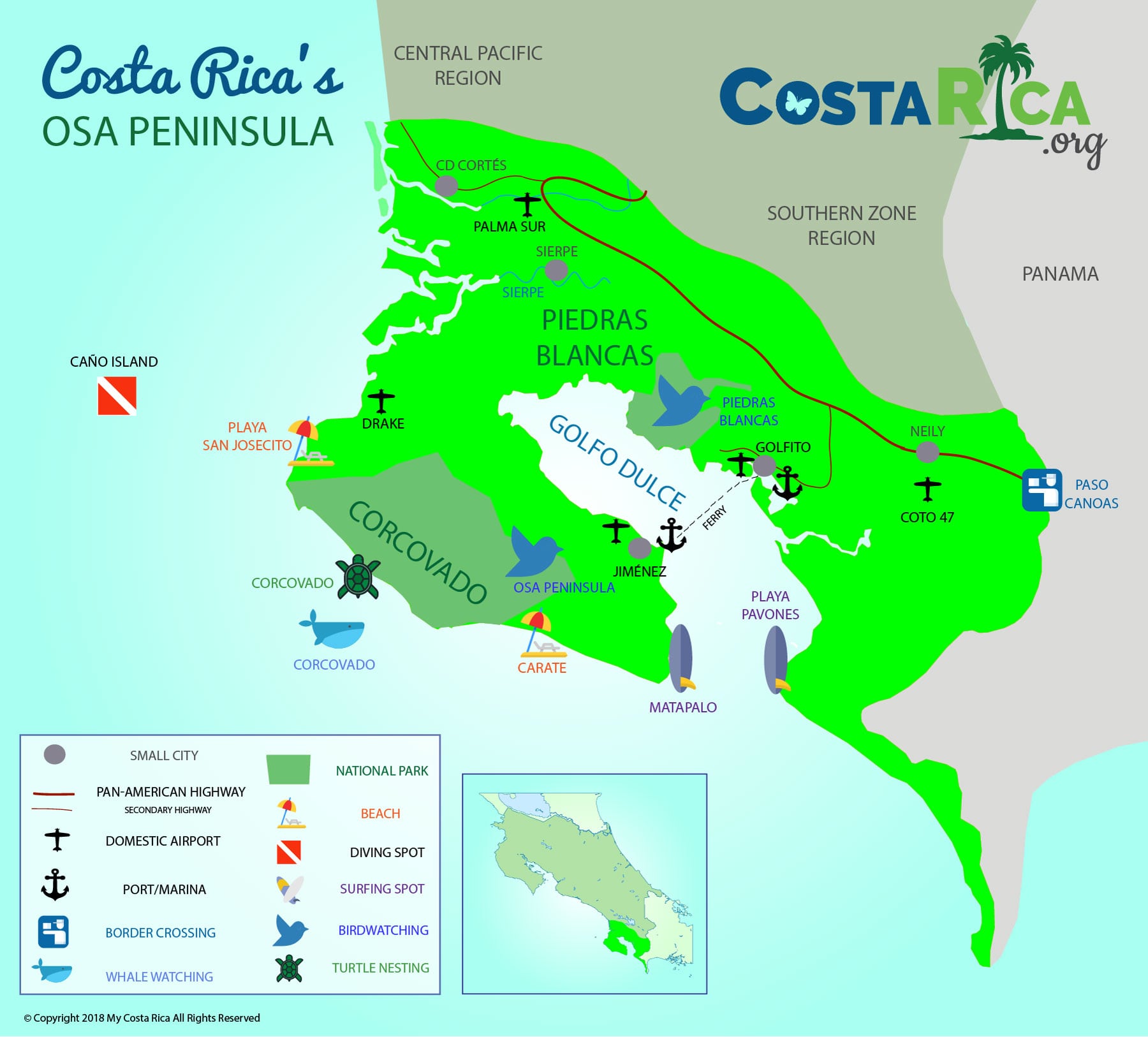
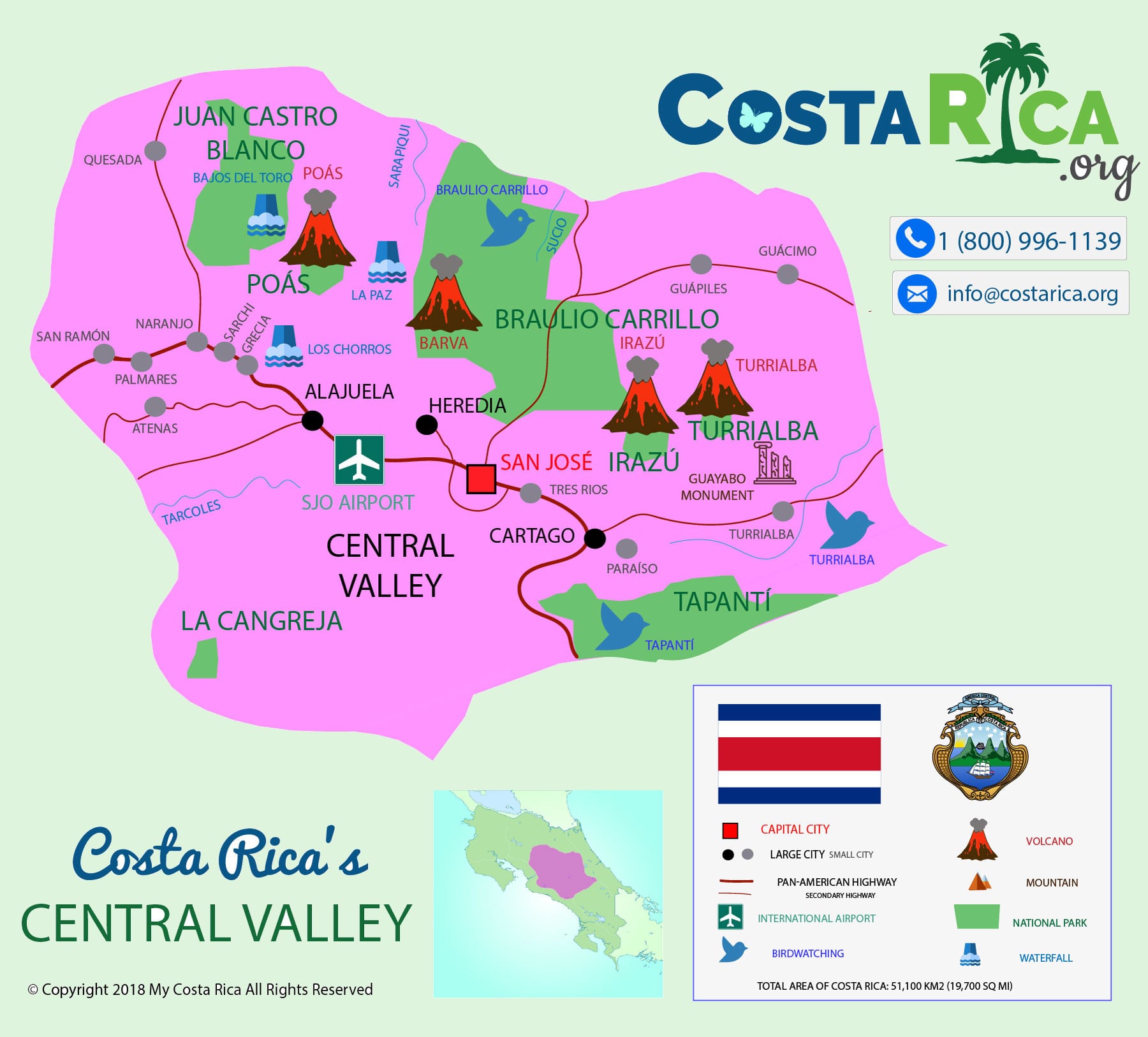
We plan every trip around eight regions. Each links to its own guide, and each has a detailed map of its own below the table.
| Region | Places you will hear about | Usually reached from |
|---|---|---|
| Northern Zone | Arenal Volcano and La Fortuna, Monteverde, Río Celeste, Bajos del Toro, Sarapiquí | San José or Liberia |
| Guanacaste | Tamarindo, Conchal, Flamingo, Papagayo, Liberia, Rincón de la Vieja | Liberia |
| Nicoya Peninsula | Sámara, Nosara, Santa Teresa, Montezuma | Depends on the beach; we advise per trip |
| Central Pacific | Manuel Antonio, Jacó, Tárcoles | San José |
| Southern Zone | Uvita, Dominical, San Gerardo de Dota | San José |
| Osa Peninsula | Drake Bay, Puerto Jiménez, Golfo Dulce, Corcovado | San José |
| Central Valley | San José, Poás Volcano, Turrialba and the Pacuare River | San José |
| Caribbean | Tortuguero, Puerto Viejo and the south Caribbean coast | San José |
Tap a map to open it full size.



Should you fly into Liberia or San José?
This one choice shapes the whole itinerary, so it is the first thing we look at with you.
Liberia (LIR) opens up Guanacaste, with a wide choice of beach hotels and all-inclusive resorts. Papagayo is about an hour from Liberia and Tamarindo about two.
San José (SJO) has fewer beaches within reach, mainly Manuel Antonio, about three hours away, but it is the gateway to the wilder south, the Osa Peninsula. Arenal works from either airport.
Costa Rica’s civil aviation authority lists two more international airports, Tobías Bolaños in San José and Limón on the Caribbean. Small domestic flights leave from Juan Santamaría and Tobías Bolaños. More in our airports guide and on domestic flights.
How long are the drives between places in Costa Rica?
Longer than the map suggests, because most routes cross mountains. These are the times on our own itineraries, from 704 trips planned between October 2025 and October 2026:
| Route | Usual time |
|---|---|
| Liberia to Arenal | About 3 hours |
| San José to Arenal | 3 to 3.5 hours |
| Arenal to Monteverde, by taxi, boat across Lake Arenal and taxi | About 3.5 hours |
| Arenal to Manuel Antonio | About 5 hours |
| Arenal to Tamarindo | 4 to 4.5 hours |
| San José to Manuel Antonio | About 3 hours |
| Liberia to Tamarindo | About 2 hours |
| Liberia to Papagayo | About 1 hour |
Most of our clients never rent a car. A private driver takes them door to door, and the stops along the way are theirs to choose. More on getting around.
Costa Rica tourist maps: beaches, attractions, parks and airports
Every one of these detailed maps was drawn by our team for planning a trip. Tap one to open it full size.
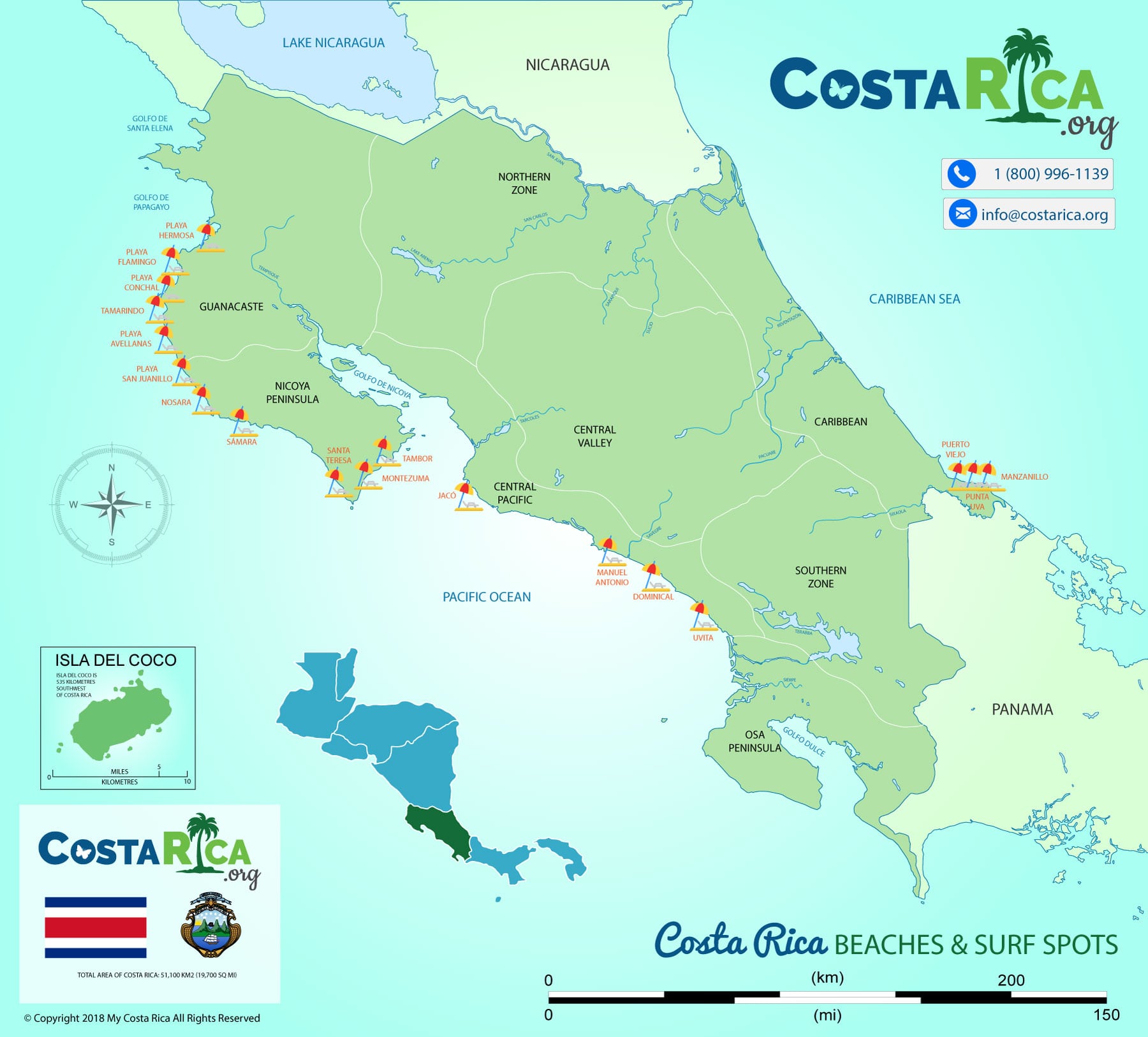 Beaches
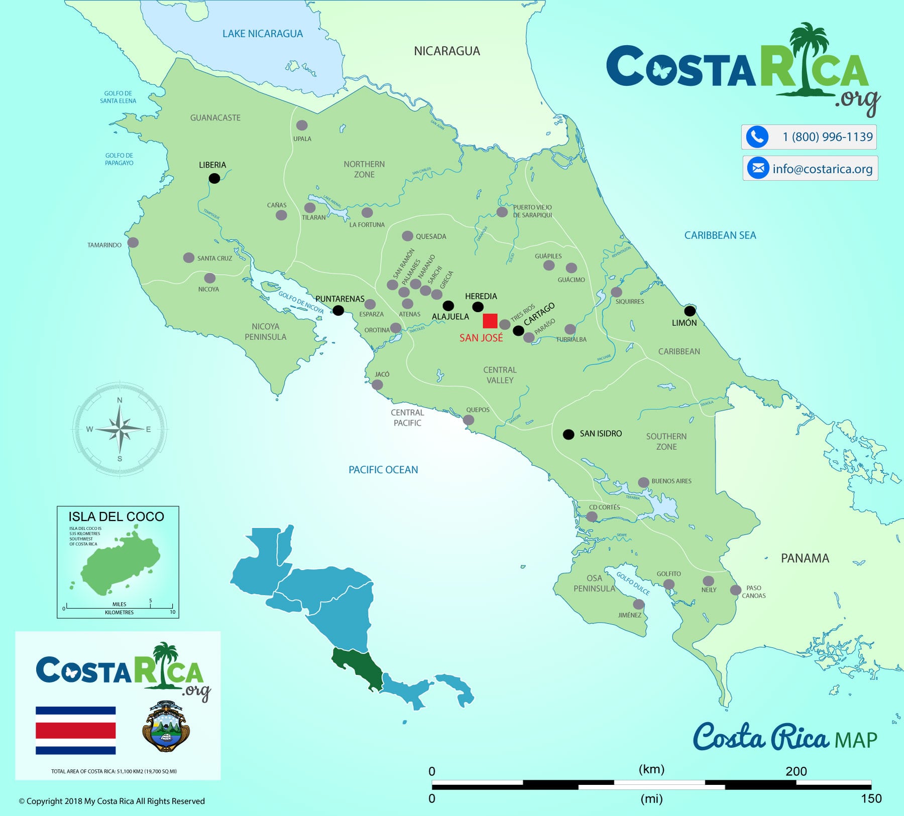 Cities and towns
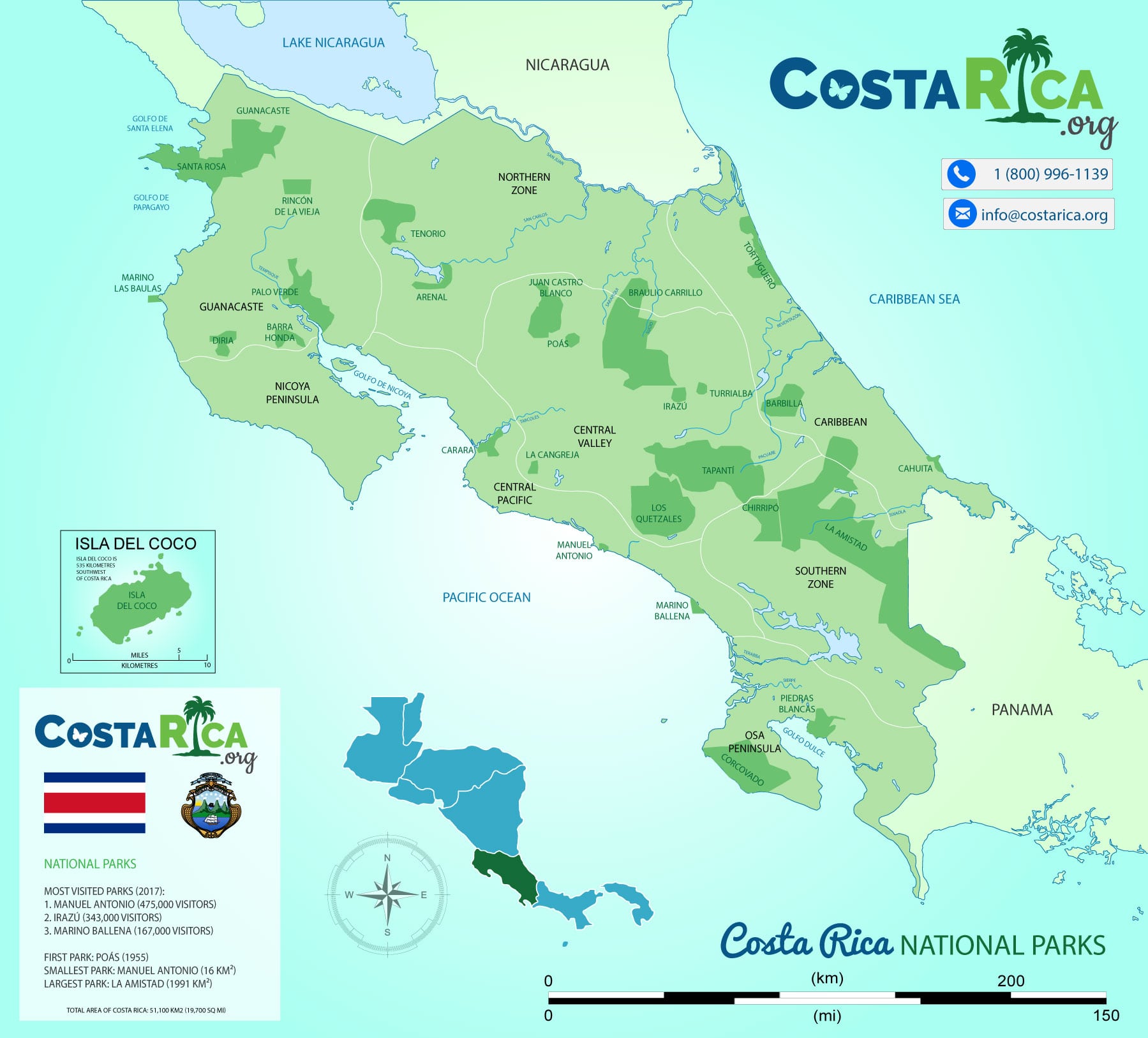 National parksVolcanoes
 Waterfalls
 Surf spots
 Diving
 Birding
 Marine wildlife
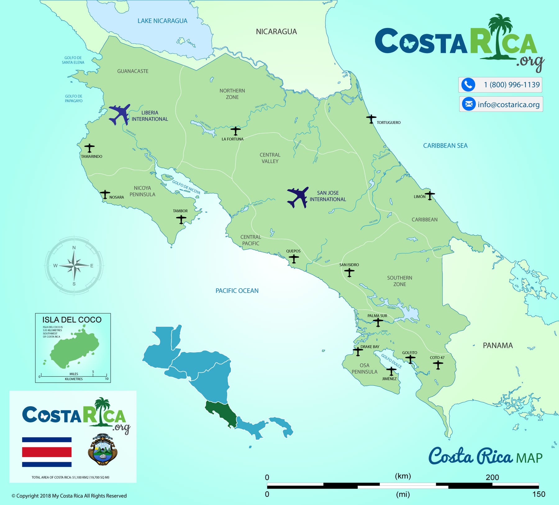 Airports
 Highways
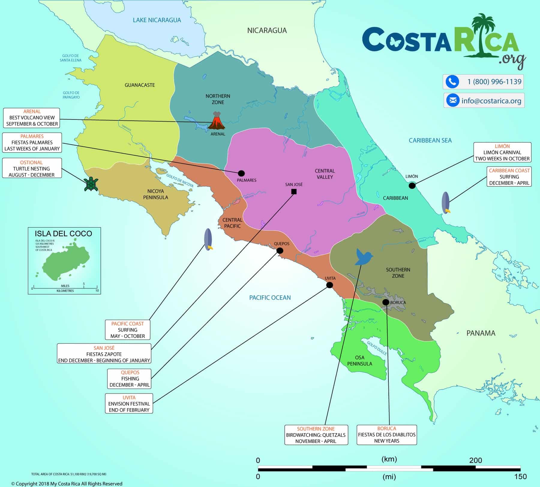 Best time to visit
Planning around one thing you love, like surf, birds or whales? Tell us, and we will put the right map to work.
What this means for your trip
Start with the airport, then pick two regions for a week, or three for nine or ten days.
The classic first trip is three nights in the rainforest around Arenal and four at a beach. With nine or ten days a third stop opens up, and that is where trips get really good:
- From San José: Arenal, Monteverde and Manuel Antonio, or Arenal, Manuel Antonio and the Osa Peninsula
- From Liberia: Arenal, Monteverde and Guanacaste
- Coast to coast: Tortuguero, Arenal and Manuel Antonio
Some of the routes our travellers take across this map, each with its own page:
| Route | For |
|---|---|
| Best of Costa Rica | A first trip that sees the highlights |
| Costa Rica’s Top 3 Destinations | Three classic stops in one trip |
| Two Oceans and a Volcano | Both coasts and a volcano in between |
| Best of Guanacaste | Flying into Liberia for the Pacific beaches |
| Perfect Combination with Corcovado | Couples heading for the wild Osa Peninsula |
| Birding in Costa Rica’s Eco-Zones | Birders working through the habitats |
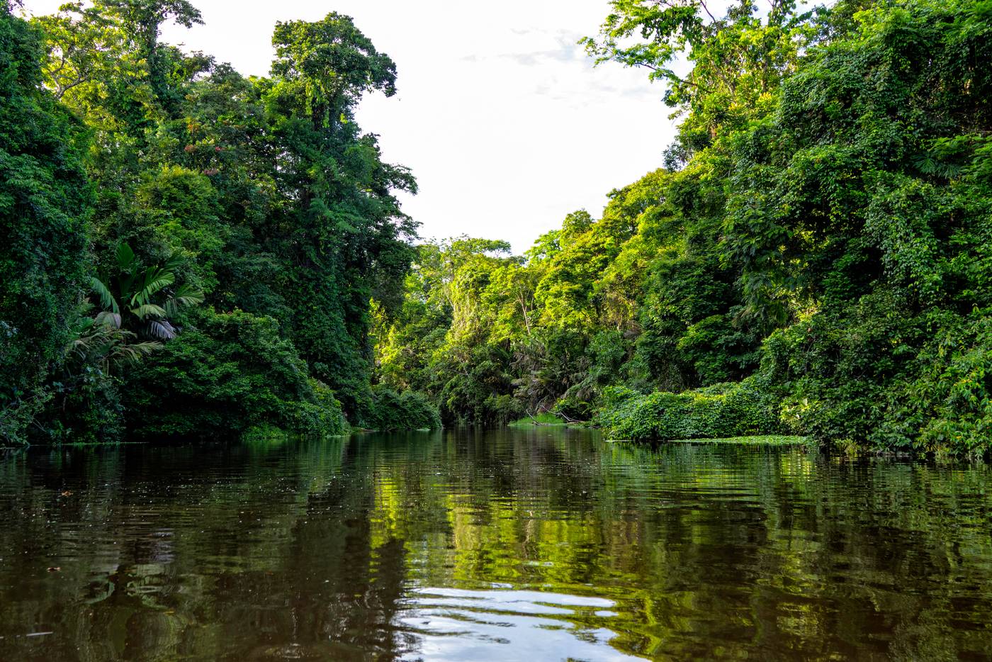
Everyone experiences Costa Rica in their own way. Tell us what you love, sloths or surf or volcanoes, and we will draw the route around it. Our vacation packages show some of the shapes, and the best time to visit guide covers the seasons.
Sources we checked on 1 November 2026
- Encyclopaedia Britannica: Costa Rica, updated 1 November 2026
- Encyclopaedia Britannica: Costa Rica’s relief
- Costa Rica Tourism Board: frequently asked questions
- Costa Rica Tourism Board: press kit, the seven provinces
- Dirección General de Aviación Civil: international airports
- National Seismological Network, University of Costa Rica: how many volcanoes
The Costa Rica map: common questions
Is Costa Rica an island?
No. Costa Rica is on the Central American mainland, between Nicaragua and Panama, with a Caribbean coast and a Pacific coast.
Is Costa Rica in South America?
No. It is in Central America, on the strip of land that joins North and South America. Panama lies between Costa Rica and South America.
What continent is Costa Rica in?
Costa Rica is in Central America, the land bridge between North and South America. It is not part of South America.
How big is Costa Rica?
19,730 square miles, about 51,100 square kilometres. Small enough to see two or three regions in a week or ten days, and big enough that the drives take longer than the map suggests.
What are Costa Rica’s main landforms and physical features?
Two mountain chains run down the middle: the volcanic ranges in the north and centre, and the Cordillera de Talamanca in the south, where Cerro Chirripó is the highest point. Lowlands line both coasts, the Caribbean lowlands being the larger, and the Nicoya and Osa peninsulas reach into the Pacific.
Is Costa Rica mountainous?
Yes, through the middle. Mountain ranges run almost the whole length of the country, with lowlands along both coasts, so most trips combine time in the mountains with time at the beach.
How many provinces does Costa Rica have?
Seven: San José, Alajuela, Cartago, Heredia, Guanacaste, Puntarenas and Limón. For a trip, the eight travel regions on this page are more useful than the provinces.
Which airport is closer to the beaches?
Liberia (LIR), for the Guanacaste beaches: about an hour to Papagayo and two to Tamarindo. For Manuel Antonio, San José (SJO) is closer, at about three hours.
Plan with this
Your route, planned by people who live here
My Costa Rica is a destination management company based in Costa Rica since 2004. We contract directly with hotels, drivers and guides, so every trip is built by people who live here and supported by our own team 24/7 while you travel.
Over 25,000 Satisfied Clients Since 2004!





Recent Posts
Costa Rica Weather in December
Summer begins on the Pacific side in December. The first two weeks are a favorite of ours, before it gets…
Costa Rica Weather in November
The rain eases through November as we move toward summer on the Pacific side, and the first northern humpbacks return…
Costa Rica Weather in October
October is one of the two wettest months on the Pacific side, and one of the quietest of the year.…
Costa Rica Weather in September
September and October are the wettest months on the Pacific side. This is when the Caribbean coast has its own…